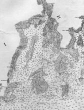
Penobscot Bay Chart 1880
Penobscot Bay Maine Nautical Coast Chart No. 4, 1/80,000 scale. This was the first complete chart of Penobscot Bay published by the U.S. Government.
Database ID:
1972.11
Year:
1880
Geographic Location:
Penobscot Bay, Maine
Creator:
U.S. Coast and Geodetic Surve
Keywords:
Category:

