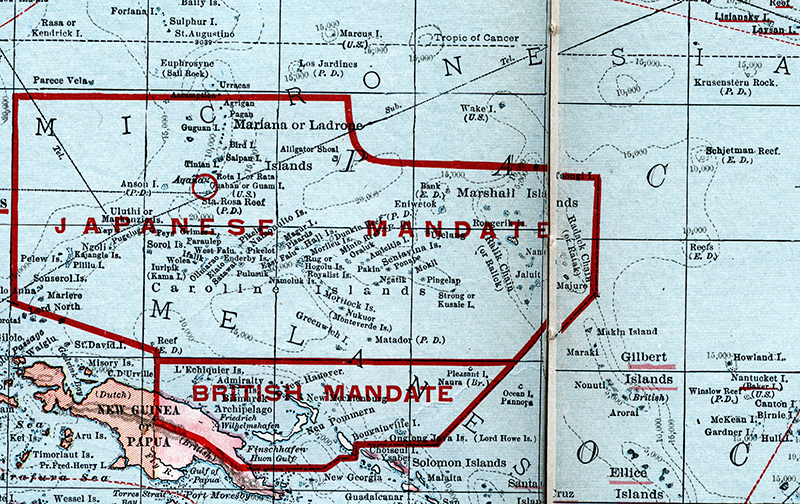
Micronesia refers to a region in the Pacific Ocean containing thousands of small islands. It lies east of the Philippines and northeast of Indonesia. Some of the island groupings within Micronesia are the Caroline Islands, the Gilbert Islands, and the Mariana Islands. Micronesia is distinct from Melanesia to the south and Polynesia to the east. This image is from Hammond's Unabridged Atlas and Gazeteer of the World, published by C. S. Hammond & Co., Inc., New York, 1924, page 90. (Collections of Penobscot Marine Museum)
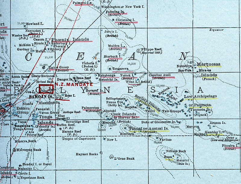
The Society Islands are a group of islands in the South Pacific Ocean, part of French Polynesia. They were named by Captain James Cook. The most well known of these islands is Tahiti.
This image is from Hammond's Unabridged Atlas & Gazeteer of the World, published by C. S. Hammond & Co., Inc., New York, 1924, page 91. (Collections of Penobscot Marine Museum)
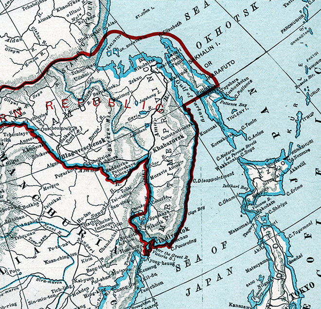
Sakhalin Island is a large island in the North Pacific Ocean, just north of Japan and close to the eastern coast of Russa. It is owned by Russia, but has historically been the subject of territorial disputes between Russia and Japan.
This image is from Hammond's Unabridged Atlas & Gazeteer of the World, published by C. S. Hammond, New York, 1924. (Collections of Penobscot Marine Museum)
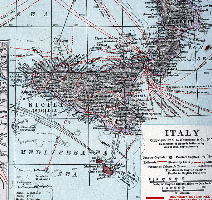
Sicily is the largest island in the Mediterranean Sea. It is an Italian autonomous region and lies just off the southernmost tip of Italy. This image is from Hammond's Unabridged Atlas & Gazeteer of the World, published by C. S. Hammond & Co., Inc., New York, 1924. (Collections of Penobscot Marine Museum)
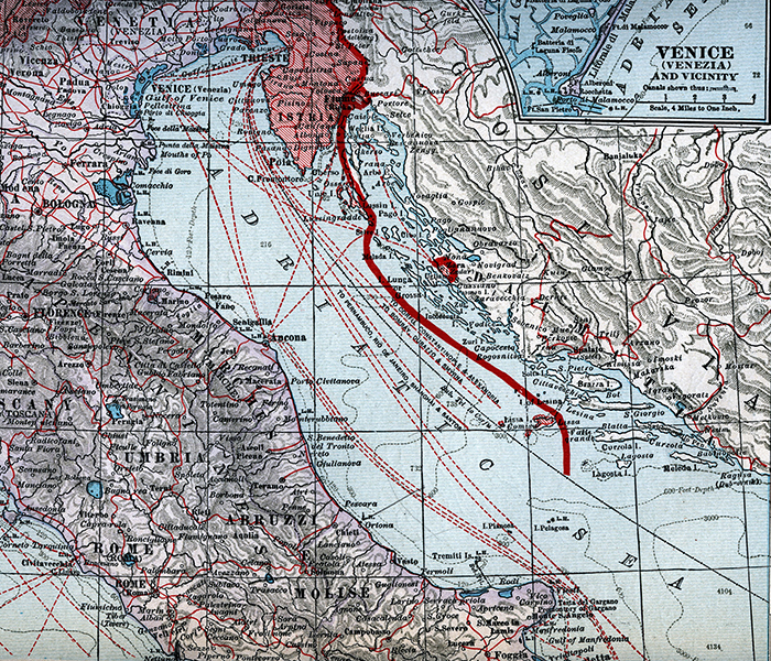
The Adriatic Sea is the body of water separating Italy from the Balkan peninsula, which includes the present-day countries of Bosnia-Herzegovina, Albania, Croatia, Montenegro and Slovenia. The Adriatic is the northernmost arm of the Mediterranean Sea. This image is from Hammond's Unabridged Atlas & Gazeteer of the World, published by C. S. Hammond & Co., Inc., New York, 1924, page 50. (Collections of Penobscot Marine Museum)
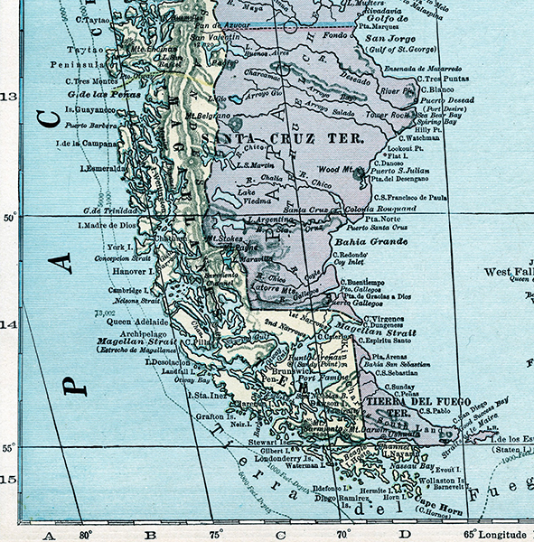
The Strait of Magellan connects the Atlantic Ocean to the Pacific Ocean just north of Cape Horn, which is the southernmost tip of the continent of South America. This map image is from Hammond's Unabridged Atlas and Gazeteer of the World, published by C. S. Hammond & Co., Inc., New York, 1924, page 121. (Collections of Penobscot Marine Museum)
Detail of Sunda Strait and its Approaches chart, showing the strait between Sumatra and Japan. This was one of the most important passages on the route to and from China. Note the island of Krakatoa, where the volcano erupted in 1883.
Detail of map, showing Native American and their boats.
From VISSCHER, Nicolaas Jansz, Map of New Belgium, New England and Virginia first published in 1655 with editions up to 1727, published in Amsterdam.
Like all maps of that era, titles were in Latin. NOVI BELGII / NOVÆQUE ANGLIÆ NEC NON / PARTIS / VIRGINIÆ TABULA / multis in locis emendata a / Nicolao Joannis Visscher.