Approaches to Navigation
Navigators use written, graphic and numeric information, published for their use, in addition to their own senses and memories.
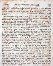
Written—Sailing Directions
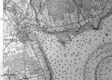
Before the 19th century when chartsChart
A nautical map giving navigation information, including: water depth; shoals, rocks, and other dangers; and aids to navigation such as lighthouses, buoys, and beacons. Charts use special symbols and abbreviations to convey information for mariners. became common, pilots kept ruttersRutter
First a manuscript then a printed book of sailing directions describing harbors and routes along with landmarks and other navigational information.
Read More or sailing directionsSailing directions
Originally called "routiers" or "rutters", written directions for navigation., written descriptions of routes and harbors. Some gave general information about compassCompass
Instrument which indicates true or magnetic north, enabling the mariner to guide a ship in any direction and to determine the direction of a visible object, such as another ship, heavenly body, or point of land.
Read More courses to steer along coasts. Some provided drawings of the landscape near shore. Original rutters sometimes were hand-written notebooks of directions to specific ports. Keeping a record of directions was an important part of a sailor’s preparation to become a captain. Sailing directions are still published—now often with aerial photographs instead of drawings.
Graphic—Nautical Charts
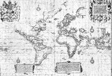
The earliest nautical charts were maps rather than charts, showing land, but not water depths. In 1569, Gerardus MercatorMercator, Gerardus Gerardus Mercator
1512-1594. Flemish mathematician and geographer who, after moving to Germany in 1552, invented the map projection named after him. His world map was first published in 1569. showed how to depict the spherical globe on a flat piece of paper. It took decades for his work to be universal and for soundingsSounding
The name given to a depth of water obtained by a lead and line sounding machine, or echo-sounder, or by any other means. The figures on a maritime chart which indicate the depth of water are also known as soundings. to appear on charts. Not until the late 17th century were atlases of coasts published that provided important graphic data to the navigator, and only wealthy captains and owners could afford them.
In the United States, the government was slow to create detailed charts, so private chart publishers sold their own. It wasn’t until the 1870s and 1880s that the U.S. Coast Survey published charts of much of the Maine coast. Charts provide a tremendous amount of valuable data, helping the navigator plot courses, avoid rocks and dangerously shallow areas, find good fishing grounds, and identify safe harbors.
Numeric—Electronic Data
Any position on the globe may be described numerically, most commonly as latitudeLatitude
Latitude is the measure of how far north or south one is from the equator. This angular measurement is given in degrees, minutes (1/60th of a degree), and seconds (1/60th of a minute) of arc.
Read More and longitudeLongitude
Longitude lines around the globe run north-south, and measure position east or west of a reference line.
Read More. Speed and direction are also given numerically. With modern electronic navigational instruments, a navigator must be familiar and comfortable working with numeric data as well as verbal and graphic descriptions.


