Navigation in the 19th to 20th Centuries
Foundations for advancing navigation had been laid by 1800; more developments made these advances practical for mariners, including most of Maine’s sailing ship captains who went to sea in the nineteenth century.
Deep sea navigators benefited as chartsChart
A nautical map giving navigation information, including: water depth; shoals, rocks, and other dangers; and aids to navigation such as lighthouses, buoys, and beacons. Charts use special symbols and abbreviations to convey information for mariners., publications and instruments became available and affordable to the average captain. Surveys and sailing directionsSailing directions
Originally called "routiers" or "rutters", written directions for navigation. became more accurate, and oceanographic and weather data was collected and put into an accessible form. Those sailing to familiar ports on a regular basis or those fishing off the coast of Maine had learned most of the needed landmarks, compassCompass
Instrument which indicates true or magnetic north, enabling the mariner to guide a ship in any direction and to determine the direction of a visible object, such as another ship, heavenly body, or point of land. There are two types, the magnetic compass which depends on the earth's magnetic field to obtain its directive force and the gyrocompass, which obtains its directive force from the rotation of the earth. courses, and depths, but they also benefited from accurate charts and government-installed aids to navigationAids to navigation
Aids to navigation are artificial aids that have been created or built to aid the navigator. Buoys and lighthouses are examples..
Dead Reckoning Tools
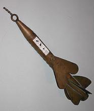
Mechanical logsPatent log Mechanical log, taffrail log
Colloquial term for any mechanical log or speed measuring device. These were all patented by their inventors., first invented around the middle of the 17th century, became practical and reliable around the mid-1800s. These mechanical logs measured distance traveled, like an odometer. An impellerImpeller
A rotor or rotor blade. In pumps and turbines, it is powered and moves air or other fluids. In measuring instruments, it is moved by a fluid passing it, and rotations can be counted. was turned by water flow; a mechanical counter recorded these impeller turns, converting them to nautical milesNautical Mile
One minute (or 1/60th of a degree) of latitude. Because the earth is not a perfect sphere, the length of a nautical mile varies somewhat according to latitude.
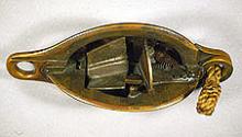
Read More. Some logs, including Walker's Harpoon logWalker patent log Walker's Harpoon Log
A patent log is a self-recording device consisting of a rotator towed behind a ship. The number of revolutions of the rotator in a certain time period could be used to calculate the speed of a ship. Thomas Walker was widely associated with the development of the modern patent log.
Read More of the 1860s, had the dials on the same part that had the impeller. The log had to be recovered and released for every log entry. Taffrail logsTaffrail log
Type of mechanical or patent log that used an impeller and a stiff line that when spun read directly on a dial mounted to the taffrail. It could be would give instantaneous distance from when the log's impeller was launched and/ or speed depending on the log., where the impeller turned a stiff rope attached to a geared readout mounted on the taffrail of the ship, did not have to be hauled. The patent logs of the 19th century improved the quality of dead reckoningDead reckoning
Navigating by applying courses and distances made through the water from the last known observed position. The term dead could be a form of "ded" from "deduced" reckoning. entries, thus improving navigation both at sea and along coasts.
Taking advantage of the same concepts of the patent logs, but far less common were mechanical depth soundersDepth sounder
A mechanical or electronic machine used to measure water depth.. One type used impellers to measure depth by counting the rotations the impeller made as it was dropped. Another type measured depth using seawater pressure. It used a glass tube, open on one end. As the air-filled tube was dropped the increasing water pressure pushed an indicator, compressing the air, further into the tube. When raised the indicator did not move out and the depth was read.
Publications for the Mariner
After the Napoleonic Wars and the War of 1812War of 1812
1812-1814. War declared on Great Britain by the United States. Objectives were several, including plans to "liberate" Canada.
Read More, major nations sent a flurry of exploring expeditions around the world. These expeditions brought back data on weather, oceanography, and coasts. They formed the foundation for much of the information that navigators continue to use.
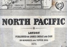
Commercial publishers had been producing charts and sailing directions since the early 19th century. But it was not until the mid 19th century that chart publication became largely governmental and even then, commercial publishers continued to print charts.
In Britain, the Admiralty began publishing its own charts. From 1829 to 1855, its famous hydrographer, Francis BeaufortBeaufort, Francis Sir Francis Beaufort
1774-1857. Irish hydrographer and Royal Naval officer. During his naval career in the Napoleonic Wars during which he rose to captain, he surveyed when he could.
Read More, led the Hydrographic Office, and made the Admiralty chart the world-wide standard. Commercial publishers used Admiralty and other information to publish blueback charts for merchant ships, used by British and American captains alike.
The United States Coast Survey was formed in 1807 by Thomas Jefferson to chart American coasts. The Coast Survey’s founder Ferdinand R. HasslerHassler, Ferdinand R. Ferdinand R. Hassler
1779-1843. Born in Switzerland, he emigrated to the United States in 1805. Employed as a teacher of mathematics and surveying at West Point, he was hired to begin a coast survey in 1811.
Read More was a careful surveyor, but it was not until his successor, Alexander Dallas BacheBache, Alexander Dallas Alexander Dallas Bache
1806-1867. Graduated from West Point in 1825. Appointed second superintendent of the United States Coast Survey in 1843. Became first president of the National Academy of Sciences, that many charts were published for government and commercial use.
Bache, great-grandson of Benjamin Franklin, led the U.S. Coast Survey from 1843 to 1865.
In the late 1870s and 1880s the Coast Survey began to publish detailed charts of the Maine coast. Before then, captains learned the coast by eye and used less-detailed privately-published coastal charts.
Edmund M. BluntBlunt, Edmund M. Blunt Edmund M. Blunt
1770-1862. Publisher of nautical books and charts based in Newburyport, Massachusetts. Began publishing The American Coast Pilot in 1796 under the nominal authorship of a Captain Lawrence Furlong. Became publisher of Bowditch's New American Practical Navigator.
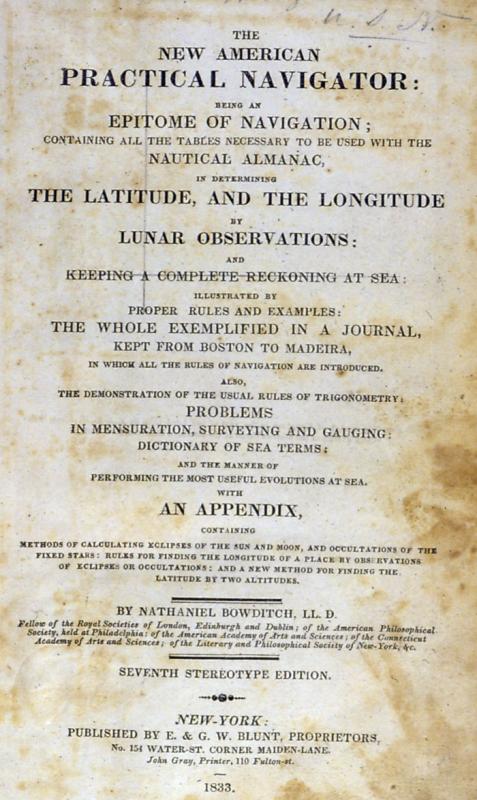
Read More, and later his two sons, Edmund and George W., published the two most important pre-Civil War American navigational texts: Nathaniel Bowditch'sBowditch, Nathaniel Nathaniel Bowditch
1773-1838. American scientist, captain, navigator and mathematician. During his voyages at sea, he recomputed many of the English navigational tables then in use.
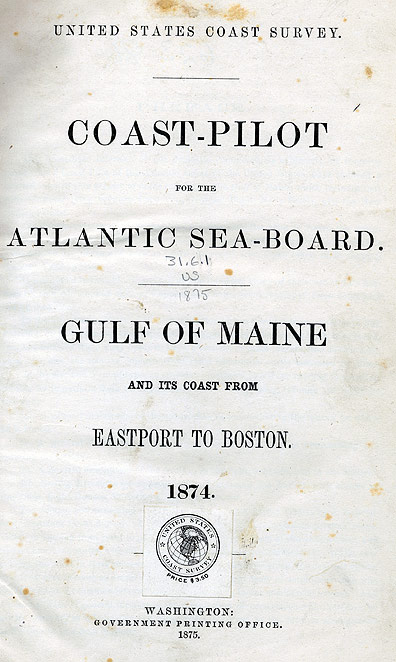
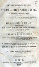
Read More 1802 The New American Practical Navigator and The American Coast Pilot (pictured above). The Practical Navigator included basic instruction on navigation and tables to help solve problems. Searsport’s captains honored Bowditch by naming a cemetery for him. Blunt’s The American Coast Pilot, published from 1796 to 1867 provided sailing directions for the East Coast. It was replaced by the U.S. Coast Survey’s sailing directions, first published in 1878. Much of this work was prepared by Lieutenant Matthew Fountaine MauryMaury, Matthew Fountaine Matthew Fountaine Maury
1806-1873. Naval officer and oceanographer. Joined the US Navy in 1825, became superintendent of the Navy's Hydrographic Office in 1839 and in 1842 the superintendent of the Depot of Charts and Instruments.
Read More.
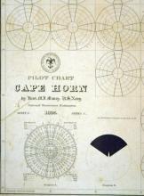
From the 1840s to 1860s Lieutenant Maury was responsible for collecting and publishing wind and current data, using information compiled from thousands of ship’s logs. In 1847 the Navy published a North Atlantic wind and current chart, followed by a more general publication of pilot charts showing winds and currents of all oceans. These, along with sailing directions, helped navigators select routes to take advantage of favorable winds and currents. Maury never received due credit because he joined the Confederate Navy during the Civil War.
The nineteenth century also saw developments in celestial navigationCelestial navigation
Using the sun, moon, stars, and planets to find your location. sight reductionssight reduction tables
Tables that allow celestial sights to be transformed into a vessels' position using precomputed data. Data needed are the altitude of the body observed, the ships estimated or dead reckoning position, and the time. The only calculations needed are adding and subtracting. The process is called sight reduction. that simplified calculation of position.
Instruments for Celestial Navigation
Production chronometersChronometer
A very accurate timepiece hung in gimbals and kept in a special box aboard ship. It is designed to minimize errors due to temperature variation and movement.
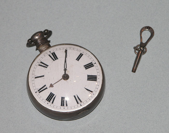
Read More were the most important instrument for celestial navigation, but there was also steady improvement in altitude measuring instruments.
SextantsSextant
A portable reflecting astronomical instrument for measuring angles. It is mainly used to measure the altitude of heavenly bodies at sea, but can also be used to determine horizontal angles between landmarks in order to fix a position.
Read More and octantsHadley's Quadrant octant
John Hadley invented his "reflecting quadrant" in 1731, the direct ancestor to the modern sextant.
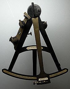
Read More were steadily reduced in size and had features added. Most were made in England. The octant or Hadley’s quadrantHadley's quadrant octant
John Hadley invented his "reflecting quadrant" in 1731, the direct ancestor to the modern sextant. Called a reflecting quadrant for most of the 18th century and quadrant in 19th century America, it actually has an arc of 45 degrees hence its modern name of octant.
Read More with its wooden frame went out of fashion and production by about 1850, superseded by the sextant which could be more easily used to measure lunar distancesLunar distance
Longitude by lunar distances involves using the relationship of the moon with stars as a giant clock. Measuring the Moon's position relative to stars lets time be read.
Read More. Sextant makers focused on using metal frames to support the longer arc. These started to be made in quantity shortly into the 19th century and by mid-19th century these were the standard instrument.

