Navigation in the 18th Century
Two major developments in the 18th century vastly improved navigation: the solution to the problem of finding longitudeLongitude
Longitude lines around the globe run north-south, and measure position east or west of a reference line.
Read More and the improved availability of printed guides and chartsChart
A nautical map giving navigation information, including: water depth; shoals, rocks, and other dangers; and aids to navigation such as lighthouses, buoys, and beacons. Charts use special symbols and abbreviations to convey information for mariners.. But navigation tools for dead reckoningDead reckoning
Navigating by applying courses and distances made through the water from the last known observed position. The term dead could be a form of "ded" from "deduced" reckoning. and pilotingPiloting pilotage
The art of navigating along coasts, using visual guides. were not to improve until the 1900s.
Guides for the Navigator
The eighteenth century saw major improvements in publications for navigators.
France and Britain established governmental hydrographic or surveying offices whose data, late in the century, began to be published as both charts and sailing directionsSailing directions
Originally called "routiers" or "rutters", written directions for navigation..
Using data collected in North America and the Orient, the British English Pilot continued to be corrected and republished, but was superseded by government publications.
In 1774, J.F.W. DesBarresDesBarres, J.F.W. J.F.W. DesBarres
1721-1824. Swiss born cartographer. Moving to England around 1750, he trained as a military engineer at the Royal Military Academy in Woolwich.
Read More began publishing, in England, a marine atlas of the North American coast. The Atlantic Neptune showed detailed shorelines, islands, and depths based on his and other surveys between 1764 and 1773. During the American Revolution, it likely provided valuable information for the British during the Penobscot ExpeditionPenobscot Expedition
In June of 1779, the British set up a fort at Castine. Hearing of this, the Continental Congress sent a strong expedition to drive the British out, with some forty ships and 1,000 men.
Read More in 1779, and for general operations. The atlas continued in use for more than fifty years after its last publication in 1781.
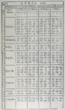
No less momentous was the 1767 publication of the first Nautical AlmanacNautical Almanac
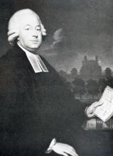
Name for the 1767 publication of astronomical tables of data for celestial navigation. It is still published. Also, any annual publication which gives the navigator all the astronomical information needed for working out position by celestial navigation.. Published by the Astronomer Royal, Nevil MaskelyneMaskelyne, Nevil Nevil Maskelyne
1732-1811. British astronomer who served as Astronomer Royal from 1765 to 1811. He established the publication of the Nautical Almanac and was instrumental in providing the data for the lunar distance method of calculating longitude.
Read More, to aid in solution of lunar distancesLunar distance
Longitude by lunar distances involves using the relationship of the moon with stars as a giant clock. Measuring the Moon's position relative to stars lets time be read.
Read More for finding longitude, its tables were the product of German astronomer Tobias Mayer, who made efforts to correct previous works. The method required accurate measurement of the angle between the moon and known stars. The Nautical Almanac is still published, and gives the locations of the sun, moon, visible planets, and stars for every hour and day of the year, data essential for celestial navigation.
In 1770, Benjamin Franklin published the first map of the Gulf Stream, something well known to sailors, but the map was not published for mariners until the 19th century.
Tools for the Celestial Navigator
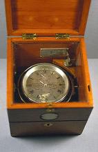
In addition to the method of lunar distances, the late 18th century saw the creation of another practical solution to finding longitude at sea: the marine chronometer. Both methods became widely used in the 19th century, when mass production provided chronometers and accurate altitude measuring instruments like octants and sextants, and publishers printed lunar distance tables.
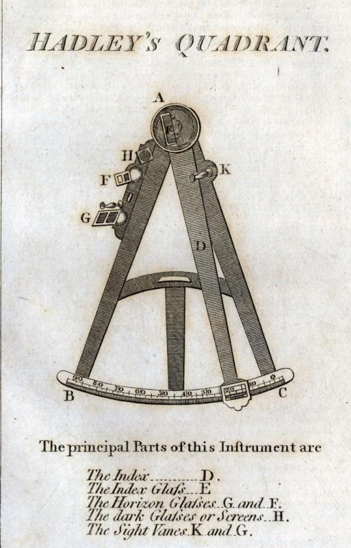
After more than a century of using the backstaff or Davis Quadrant for measuring the altitude of the sun, John Hadley invented a reflecting octant in 1731. This was the direct ancestor to the modern sextant. Instead of working with sun shadows, the Hadley octant, also known as a quadrant or Hadley’s quadrant, used mirrors to line up a reflection of the sun or other celestial object with the horizon. It could also be used for star sights, a major advantage. In 1751, the length of the arc was extended to allow measurements of up to 120°, something needed for lunar distance observations. This new instrument was the sextant.
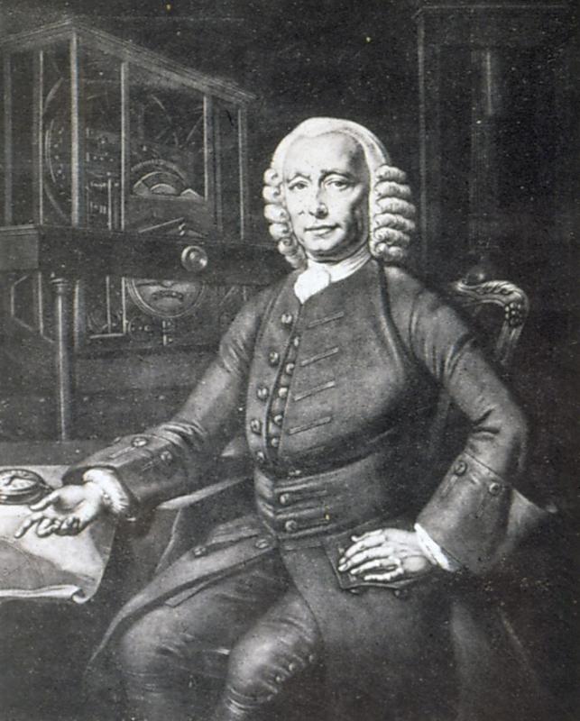
Accurate determination of longitude was the major challenge to navigation. As an incentive, in 1714 the British government’s Board of Longitude offered £20,000 to the person who solved the problem. It was finally awarded to John HarrisonHarrison, John John Harrison
1693-1776. English clockmaker who designed and built the first successful chronometers, clocks accurate enough to take to sea to measure longitude, starting in 1730. After 5 versions of his chronometer, he was finally awarded the full prize put up by the government of 20,000 pounds. in 1773, reflecting his lifelong effort to create a chronometer that was accurate at sea. The chronometer was set to the time at the Prime meridianPrime meridian
The meridian from which longitude is measured eastwards or westward. The longitude of the prime meridian is 0 degrees.
Read More, and local noon was established by the sun. The difference in times translates to longitude.
It would take the work of many others to make chronometers practical and affordable. During the first part of the 19th century only naval vessels, the largest merchant ships, and exploration vessels could afford to carry them.
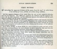
Lunar distances competed with the expensive chronometer. A navigator could find his longitude without a chronometer by using the moon as a giant clock, working its way past sun and stars.
By finding local time with daytime observations of the sun, the navigator needed to know the time at the Prime Meridian in Greenwich, the difference in time providing the longitude. The lunar sights measured the distance between the moon and nearby stars or the sun, and when compared to nautical almanac data for Greenwich of distances between the moon and stars, one could find the time at the Prime Meridian. The complex calculations were simplified by American Nathaniel BowditchBowditch, Nathaniel Nathaniel Bowditch
1773-1838. American scientist, captain, navigator and mathematician. During his voyages at sea, he recomputed many of the English navigational tables then in use.
Read More in his 1802 American Practical Navigator. Working lunars continued to be part of navigators’ training until the 1920s, when chronometers became affordable for any offshore captain.

