Using a Compass
Today large ships use a gyroscompassGyroscopic compass gyro compass, gyrocompass
An instrument receiving its directive force from a gyroscope operated by electric motors. Its directive action is based on the mechanical laws governing the dynamics of rotating bodies.
Read More, aligned with the true north True North
The direction of the North Pole from any place on the earth's surface, through which all meridians of longitude pass on maps and charts.
Read More pole. But seafarers still use the reliable thousand year old magnetic compassMagnetic compass
A magnetic compass gets its directive force from the Earth's magnetic field. The force acts on a magnetized needle or several needles affixed to a card, which rotate freely horizontally.
Read More, which points to the magnetic north pole. The difference between these two north poles is called the variationMagnetic North and Variation
Magnetic north is one of two points on the globe where the line of total magnetic force is vertical and towards which the magnetic needle points in all adjoining regions. Variation (also called magnetic declination) is the difference in direction between true north as determined by the earth's axis of rotation and magnetic north as determined by the earth's magnetism.
Read More. In Maine, the variation is about 18° West, so that if you want to go due east, true, you would add 18° to 90° then proceed on a course of 108° magnetic.
The course or bearingBearing
The horizontal angle between the direction of true north or south and that of the object of which the bearing is being taken. When the bearing is taken by a magnetic compass, subject to variation and deviation, it must be corrected before true bearing is obtained. from one spot or ship’s position to another is determined by drawing a line between the points on a chartChart
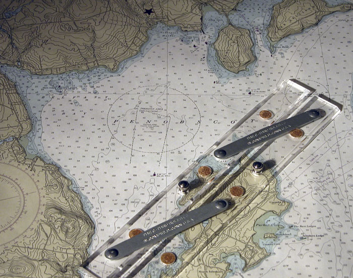
A nautical map giving navigation information, including: water depth; shoals, rocks, and other dangers; and aids to navigation such as lighthouses, buoys, and beacons. Charts use special symbols and abbreviations to convey information for mariners.. Using a parallel rulerParallel ruler Parallel rules
An instrument made up of two linked moving rulers that can be used to transfer a line from one place to another, keeping them parallel.
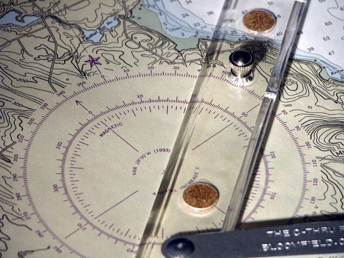
Read More or other line transferring tool, the line is “moved” to the nearest compass roseCompass rose
Outer and two inner circles engraved on a nautical chart, used for laying off courses or bearings.
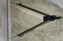
Read More. The bearing is then read on the compass rose. The outer ring reads true, and the inner ring reads magnetic. Using dividersDividers
A instrument made of two legs fastened together with a pivot at one end. It is used for transferring distances from one spot to another. If it has a marker in one leg it can be used to draw circles and is called a compass. or another distance measuring tool, the distance between the two points is transferred to the latitudeLatitude
Latitude is the measure of how far north or south one is from the equator. This angular measurement is given in degrees, minutes (1/60th of a degree), and seconds (1/60th of a minute) of arc.
Read More scale on the side of the chart, and the distance is read. When sailing the course, bearings can be taken to marks to help determine how far a vessel has traveled or where it is.
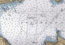
For example, using the Penobscot River chart, one can set a course by identifying where the vessel is, say, at a green gong buoy off Sears IslandSears Island
The largest undeveloped island left on the east coast. Sears Island was originally called Brigadiers Island and was owned by Henry Knox.
Read More, and placing parallel rules on a line from there to where you next want to go. If we want to proceed southwest toward a red and white bell that has a Morse codeMorse code
Method of transmitting information using just on and off pulses, with a code based on how long these pulses are on.
Read More “A” light characteristic (long on, short off, short on, long off), we set the parallel rule along the line between the two buoys. Then we “walk” the parallel rules to the nearest compass rose and find that we want to proceed on a course of 221° true (using the outer ring of the compass rose) or 239° magnetic (using the inner ring of the compass rose). The distance can be measured with a pair of dividers, which are then set along the latitude scale on the side of the chart, to see that the distance is 3.15 nautical milesNautical Mile
One minute (or 1/60th of a degree) of latitude. Because the earth is not a perfect sphere, the length of a nautical mile varies somewhat according to latitude.
Read More.
Along the way, one could determine how far the vessel has traveled by taking a bearing. If we looked over the magnetic compass and saw the red bell buoy off of Steel’s Ledge in Belfast at a bearing of 295° magnetic, we could draw a 295° magnetic line from the red bell buoy toward our course line. We would then see that the bearing line crossed the track line .65 nautical miles from our starting green gong buoy off Sears Island.

