Methods of Navigation
Navigation is broken into four sub-disciplines: pilotingPiloting pilotage
The art of navigating along coasts, using visual guides., dead reckoningDead reckoning
Navigating by applying courses and distances made through the water from the last known observed position. The term dead could be a form of "ded" from "deduced" reckoning., celestial navigationCelestial navigation
Using the sun, moon, stars, and planets to find your location., and electronic navigationElectronic navigation
Using electronic means and satellites to find your location or the location of other objects at sea..
Piloting
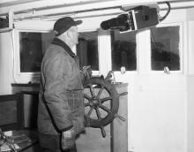
Piloting is guiding a ship through waters near shore. Large ships often use professional pilots when entering or leaving port.
Piloting a vessel uses visual landmarks and aids to navigationAids to navigation
Aids to navigation are artificial aids that have been created or built to aid the navigator. Buoys and lighthouses are examples. such as lighthouses and buoysBuoy
A floating object designed for a special purpose often anchored to the sea bottom. Buoys range in size from large navigational buoys to lobster trap buoys. to help determine the ship’s position and to plan a course. In addition to a compassCompass
Instrument which indicates true or magnetic north, enabling the mariner to guide a ship in any direction and to determine the direction of a visible object, such as another ship, heavenly body, or point of land.
Read More for direction and a logLog logbook
1. Short for logbook, a document required to be kept by merchant and naval vessels. In the log must be recorded specific information relating to the navigation of the ship, the organization of her crew, and other activities on board.
Read More to measure speed, the navigator uses a lead lineLead line
A means of finding the depth of water near coasts and probably the earliest device used by coastal navigators to facilitate safe navigation. It consists of a hemp line with a lead weight attached (about 7 pounds).
Read More or depth sounderDepth sounder
A mechanical or electronic machine used to measure water depth. to keep track of water depth.
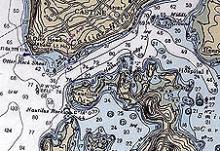
ChartsChart
A nautical map giving navigation information, including: water depth; shoals, rocks, and other dangers; and aids to navigation such as lighthouses, buoys, and beacons. Charts use special symbols and abbreviations to convey information for mariners. show navigators water depths, shoals or shallow areas, rocks, islands, points along the shore, lighthouses, landmarks, and other aids to navigation.
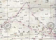
Dead Reckoning
Dead reckoning or deduced reckoning is keeping track of where the ship has been, both along shore and at sea. By recording course and speed over time, the navigator keeps track of the ship’s position. A navigator essentially adds or draws directions and distances or vectorVector
In mathematics a vector has magnitude and direction. A vector line in navigation has a length related to speed and direction related to compass bearing. lines to show the vessel’s track and its resulting location. A dead reckoning position is needed to solve some celestial navigation problems.
Celestial Navigation
A ship’s position is affected by influences besides its own course and speed, such as leewayLeeway
The distance a ship is set down to leeward (down wind) of her course by the action of wind or tide.
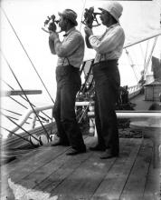
Read More and current. To check or verify the ship’s position, the navigator can use “lighthouses of the sky,” the sun, moon, stars, and planets. The angles between the horizon and these celestial bodies can be used to fixFix
The determination of a ship's position by celestial observations or by terrestrial observation of landmarks or aids to navigation, or some combination of each. The term is used only when the position is not subject to doubt. the vessel’s location.
Electronic Navigation
Navigators have used electronics since the first days of radio. Electronic navigation is now the common satellite-based global positioning systemGlobal Positioning System GPS
Satellite-based navigation system developed and operated by the United States Department of Defense becoming operational in 1993. It uses 24 satellites, and users can determine position, speed and time. (GPS). Earlier forms like loranLORAN
A system of long-range navigation invented during World War II, in which pulsed signals sent out by 2 pairs of radio stations are used to determine the geographical position of a ship or airplane. It is maintained today as a backup to GPS. relied on special land-based transmitting stations. GPS has become so reliable and easy to use that some navigators use celestial navigation methods only to keep in practice in case of a GPS or electrical failure. GPS has become so universal that it has a wide range of applications, including its use in cars.


